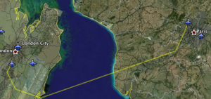
So I’ve been spending some time on Google Earth’s Flight Simulator, a little easter egg which was packaged in version 4.2. I found that it was difficult, once airborne, to fly to locations and find runways to land on (the resolution of the runways isn’t good enough until you’re too close to be able to land smoothly), so I decided to create a set of runway outlines and flight paths to serve as guides for getting from Point A to Point B.
 In this package, runways are denoted in red, and flight paths are yellow. Flight paths start at the beginning of the takeoff runway and end at the end of the landing runway (so red and yellow markers overlap), and can be flown in either direction.
The package can be downloaded here, and it contains 239 runways in 94 cities around the globe, in Europe, North America, South Asia, Oceania, Southeast Asia, Africa, East Asia, Middle East, and South America. It also contains 24 flight paths with typical routes such as New York – Chicago, and atypical routes such as Santiago, Chile to Xian, China – the longest major city to major city route possible on Google Earth. Routes are designed to provide entertainment for serious long-distance fliers and impatient ones as well (some routes can be flown in under twenty minutes).
I hope to release more runway paths and routes in the future. For now, hope this provides GEarth Flightsim buffs with something to go off of.
If you missed the download link above, here is another. Enjoy!

Comments are closed